Some links in this post are affiliate links. That means we may earn a small commission, at no additional cost to you.
Table Mountain, an iconic landmark nestled in the Table Mountain National Park, rises more than 1 000 m above the city of Cape Town. The mountain offers a plethora of hiking trails; the variation is what sets Table Mountain apart, allowing each hike to feel distinct while revealing different aspects of the mountain’s natural beauty. A pre-planned and well-thought-out hike up Table Mountain takes you from the streets of the city center to fynbos-covered slopes, rewarding you with uninterrupted panoramic views of the Atlantic Ocean, Robben Island, and the Cape Peninsula.
The mountain has several notable hiking trails, each requiring different technical skills and spanning its own distance. The Platteklip Gorge hiking trail is the most direct, however a steep incline. The Skeleton Gorge trail climbs wooden ladders through the indigenous forest. The India Venster is laden with exposed rock, suitable for confident, experienced hikers, while Kasteelspoort follows a long ridge above Camps Bay with breathtaking views of the Atlantic Ocean.
This guide spotlights the most notable Table Mountain hiking routes. We provide the distance, elevation gain, trailhead parking, and estimated time on the trail for each route. Rescue data and recent weather patterns help you match fitness, forecast, and scramble comfort to choose the safest, most suitable option. Whether you prefer an easy walk on the Pipe Track or a steep climb to Maclear’s Beacon, the sections that follow explain exactly what to expect and how you can prepare.
For many, hiking Table Mountain for the first time can be overwhelming, as its difficulty is often underestimated. First-time hikers typically experience a mix of excitement and intimidation before starting their ascent, making reaching the top of Table Mountain a significant and rewarding experience.
Why Hike Table Mountain?
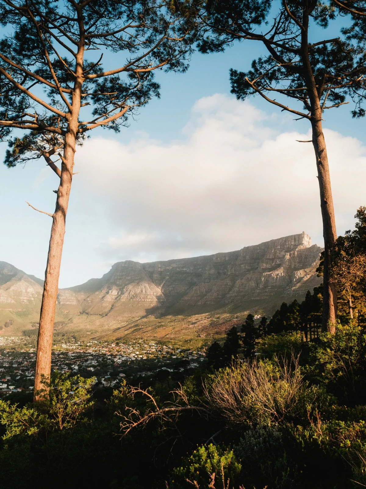
Table Mountain is one of the New7Wonders of Nature, and forms part of the Cape Floral Region Protected Areas, inscribed on the UNESCO World Heritage List. It sits within the Cape Floristic Region, the smallest yet most diverse plant kingdom on earth, with more than 2,200 plant species recorded on the mountain alone. Many of these species are endemic, meaning they occur nowhere else. This level of biodiversity, contained within a single mountain system, is one of the primary reasons the area holds global conservation significance.
Geologically, the mountain’s sandstone dates back roughly 500 million years, making it significantly older than the Himalayas. Its structure rises more than 1,000 meters directly from sea level, creating a distinct vertical landscape that shifts rapidly over short distances. This abrupt elevation is what allows hikers to experience multiple environments within a single ascent, from coastal-facing slopes to forested ravines and exposed summit rock.
Hiking Table Mountain provides direct access to this variation. Routes such as Platteklip Gorge follow a steep, defined ascent to the summit, while the Skeleton Gorge trail moves through shaded indigenous forest with consistent water flow. India Venster introduces exposed sections requiring rock climbing, and the Pipe Track offers a more gradual traverse with continuous views over Camps Bay and the Atlantic.
The mountain is also notable for its accessibility. There is no entrance fee to Table Mountain National Park, and key trailheads are located within proximity to the city, including Kloof Nek, Tafelberg Road, and Kirstenbosch Gardens. This means a high-quality hike can be completed within a half-day window without requiring extended travel. The cable car further increases flexibility, allowing hikers to ascend or descend without committing to a full return hike.
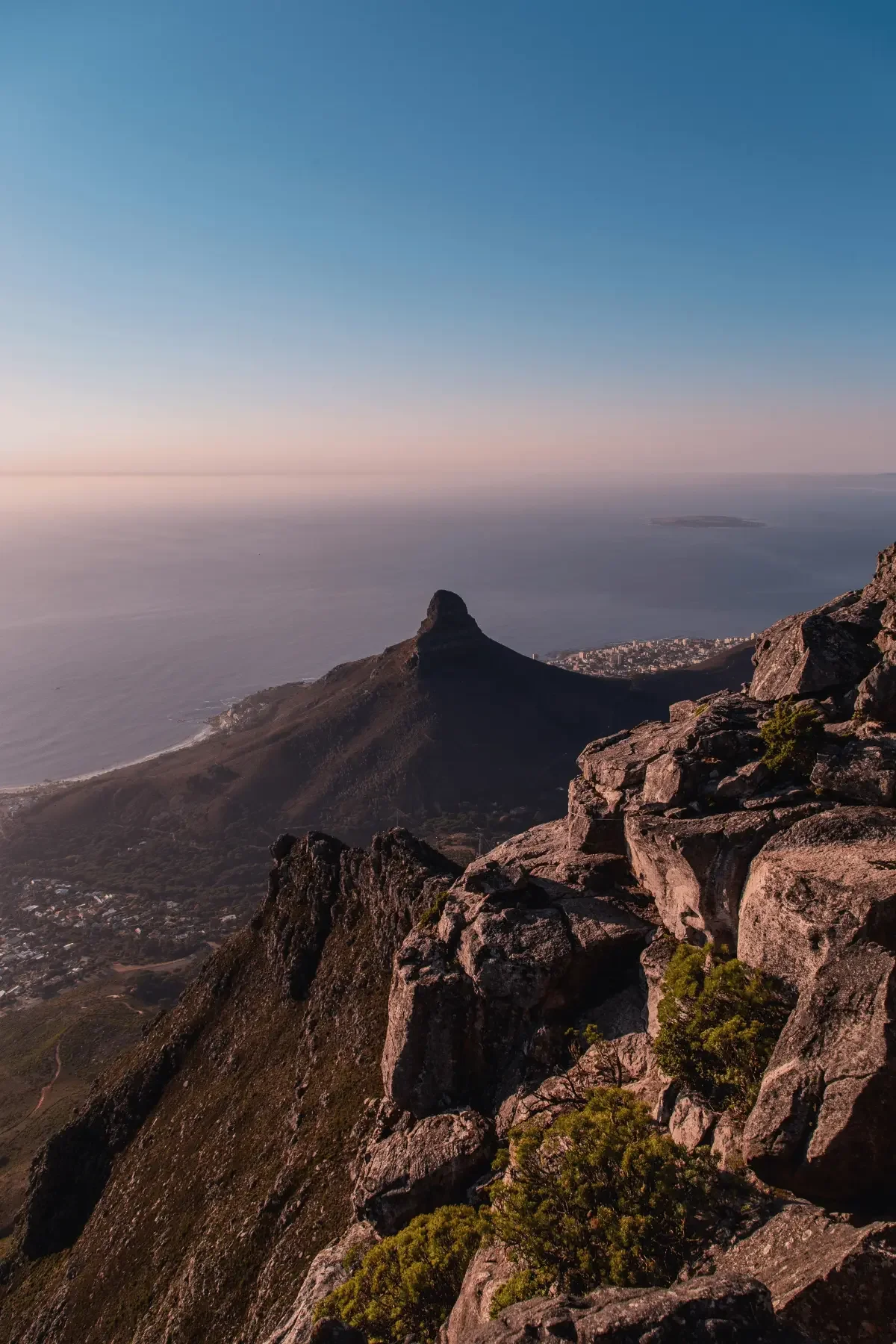
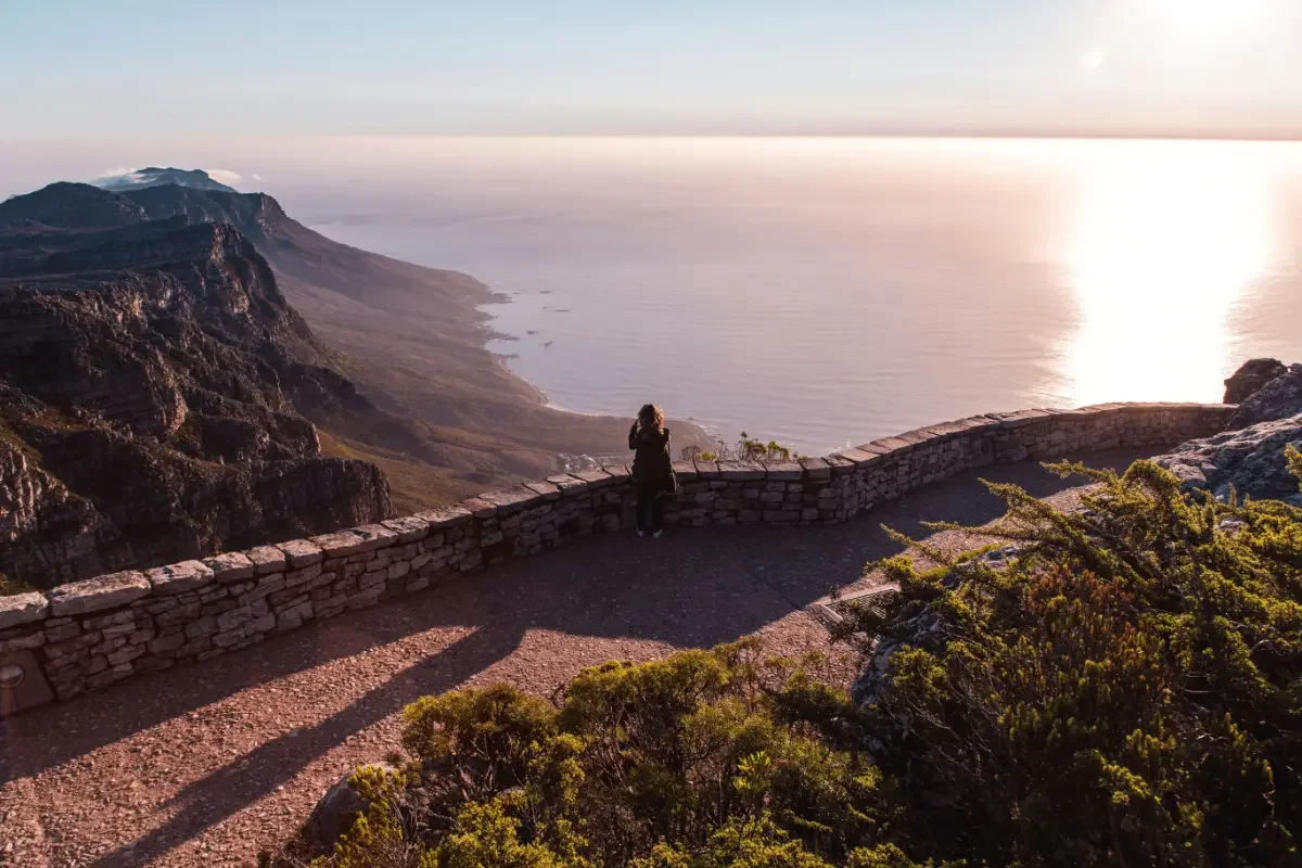
At the summit, Maclear’s Beacon marks the highest point at 1,086 meters above sea level. From this vantage point, the landscape opens in all directions. Table Bay and Robben Island sit to the north, while False Bay and the Hottentots-Holland mountains extend to the east. These views are not limited to a single lookout but unfold across the length of the plateau, which stretches several kilometres and allows for continued exploration beyond the initial ascent.
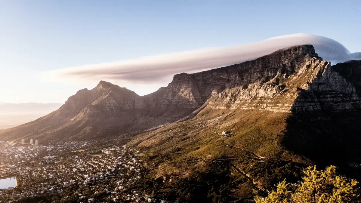
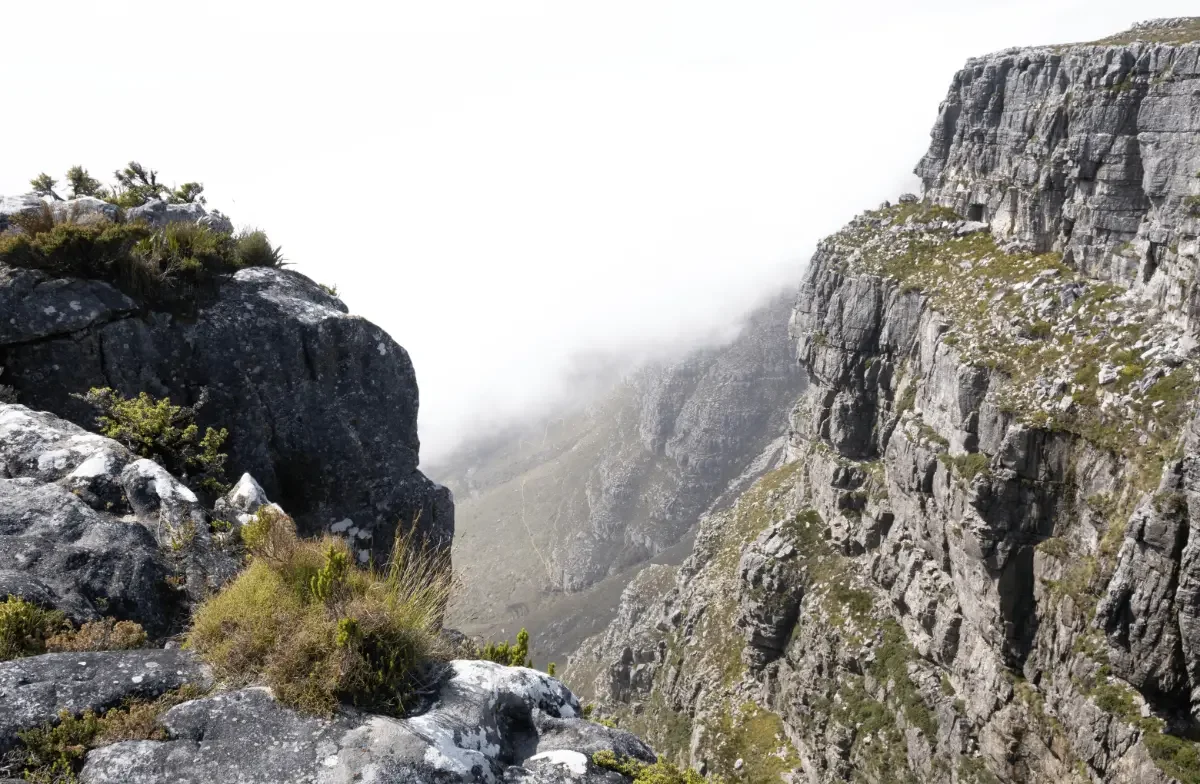
Weather patterns also play a defining role in the hiking experience. The mountain is known for rapid shifts in visibility, particularly when the south-easterly wind forms the “tablecloth” cloud across the summit. These conditions can develop quickly, even on otherwise clear days, which is why preparation, warm clothing, and timing are essential.
Hiking Table Mountain is therefore not only about reaching a summit. It offers a structured way to engage with a globally significant landscape that combines biodiversity, geological history, and accessibility in a single location. The range of hiking routes, the proximity to Cape Town, and the ability to adapt the experience to different levels of fitness make it one of the most distinctive and practical hikes available anywhere in the world.
Table Mountain National Park at a Glance
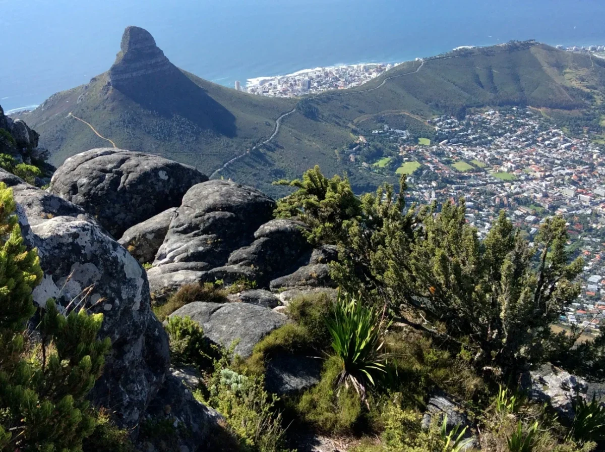
Table Mountain National Park extends across the Cape Peninsula as a protected area made up of connected sections rather than a single enclosed park. It includes Table Mountain, the Twelve Apostles, Lion’s Head, Signal Hill, Devil’s Peak, and coastal reserves, forming a continuous conservation corridor that protects both the mountain and the marine environments. The park falls within the Cape Floral Region Protected Areas, recognized for its exceptional plant diversity and ecological importance.
Management of the park focuses on conservation, fire control, and controlled public access. Certain areas operate under specific regulations, including seasonal closures due to fire risk, restricted zones to protect sensitive vegetation, and guidelines around activities such as dog walking and off-trail movement. Visitors are expected to remain on designated hiking trails and follow posted signage, as much of the terrain is environmentally sensitive and slow to recover from disturbance.
The park’s trail network is extensive and structured, with routes that connect across different sections of the mountain. This allows for a range of hiking experiences, from shorter point-to-point walks to longer traverses that link multiple areas. Trailheads are distributed along the mountain, with access points at locations such as Kloof Nek, Tafelberg Road, Camps Bay, and Kirstenbosch Gardens, making it possible to enter and exit the park from different sides depending on your chosen route.
Infrastructure within the park is intentionally limited. Apart from the cable car and facilities at key access points, there are few built structures on the mountain itself. Wayfinding relies on marked paths, signage, and navigation tools such as a Table Mountain hiking map, rather than extensive man-made guidance. This approach preserves the natural landscape while still allowing for safe and structured exploration.
Table Mountain National Park operates as both a conservation area and a public space. The balance between accessibility and preservation defines how the park is experienced, requiring visitors to plan carefully, follow regulations, and move through the environment with awareness of its ecological significance.
Choosing Your Table Mountain Hiking Route
Each route on Table Mountain follows a distinct line across the mountain, with clear differences in gradient, exposure, and terrain underfoot. Some routes move directly up the mountain face, while others traverse across the mountain before gaining height more gradually. Understanding how each route is structured will help you choose an option that aligns with your pace, comfort level, and overall plan for the day.
The sections that follow present each route individually, with key details set out in a consistent format. You will see distance, elevation gain, estimated time, and starting point, along with notes on terrain and route character. This allows for direct comparison between routes without needing to interpret varying descriptions. Certain routes include sustained climbing on uneven rock, while others introduce brief sections of exposure where footing and awareness are important. In some cases, route finding is straightforward and well-marked; in others, it requires closer attention to signage and the natural line of the path. These variations influence how a route feels in practice, beyond what the raw statistics suggest.
By reviewing each route in this way, you can identify what is appropriate for the conditions on the day and the experience you are looking for on the mountain.
Platteklip Gorge
Key Stats:
Distance: 1.5 mi / 2.4 km one-way
- Elevation gain: ≈ 2,300 ft / 700 m – a constant steep ascent on rocky stairs
- Time: 2–3 hours up; return in 5 minutes via the upper cable car station if the wind allows
- Difficulty: Moderate to hard; Platteklip Gorge’s difficulty is aerobic, not technical
- Trailhead & parking: Rocky Stairs parking on Tafelberg Road, 0.8 mi past Kloof Nek parking turn-off
- Navigation clue: Cut stone path; consult the Table Mountain hiking map grid C3
- Best window: Early morning to dodge Cape Town’s midday heat and cable-car queues
The Platteklip Gorge hiking trail is the quintessential direct route for hikers ticking Table Mountain off their Cape Town bucket list. Expect an unrelenting staircase carved into rust-red sandstone that sets your calves ablaze yet rewards you with panoramic views of the city bowl at every turn. Because the trail pops out just metres from the upper cable station, many walkers save their knees and purchase a one-way cable car ticket for the descent to the lower cable car station, slashing total elevation loss. Carry at least 2 L of water; summer temperatures often top 30 °C in the gorge.
India Venster
Key Stats:
- Distance: 1.8 mi / 2.9 km
- Elevation gain: ≈ 2,400 ft / 730 m
- Time: 2.5–3 hours up
- Difficulty: Challenging; exposed ledges, rock scrambling, occasional chains, for experienced hikers
- Trailhead & parking: Boulders parking beside the lower cable car station on Tafelberg Road
- Navigation clue: Follow the painted yellow footprints and white dots on the rocks
- Map reference: Grid C2 on the official Table Mountain hiking map
India Venster is the show-stopper among Table Mountain hiking trails, weaving up amphitheatres that stare directly into downtown Cape Town and the Atlantic beyond. Three short chain-assisted moves guard exposed, airy corners; confident hikers relish the sense of vertical theatre, while rescue teams caution that gorge difficulty spikes when walkers freeze on ledges. Start by hugging the contour path before turning steeply skyward beneath the rotating cable cars. The spectacular views make every heart rate spike worthwhile, and you can still hop on the upper cable for a painless ride down.
Skeleton Gorge to Maclear’s Beacon
Key Stats:
- Distance: 3.0 mi / 4.8 km to beacon
- Elevation gain: ≈ 2,360 ft / 720 m
- Time: 3–3.5 hours ascent; 1 hour extra if you circle back to the cable car
- Difficulty: Moderate; shaded but slippery ladders beside the waterfalls
- Trailhead & parking: Kirstenbosch Gardens entrance (paid lot)
- Map reference: Grid E4 → D3; look for Hely Hutchinson Reservoir difficulty warnings
Beginning in lush afro-montane forest, the Skeleton Gorge trail up Table Mountain climbs wooden ladders beside a tinkling waterfall before emerging on heath-covered slopes that feel a world away from bustling Cape Town. After topping out, a boardwalk skirts the emerald waters of Hely Hutchinson Reservoir and its neighbor, “Hutchinson Reservoir difficulty” signs warn swimmers off, before a gentle rise to Maclear’s Beacon, the mountain’s highest point at 3,563 ft. Many hikers then traverse the tabletop to the upper cable car station, turning a humid forest hike into a summit-to-sea panorama.

Kasteelspoort and the Twelve Apostles Ridge
Key Stats:
- Distance: 3.6 mi / 5.8 km one-way
- Elevation gain: ≈ 2,450 ft / 750 m
- Time: 3.5–4 hours up
- Difficulty: Moderate; long but rarely technical; short scramble onto the Diving Board is optional
- Trailhead & parking: End of Pipe Track at Camps Bay (parking near Theresa Avenue)
- Navigation clue: Well-trodden switchbacks; join popular routes along the Twelve Apostles crest
- Map reference: Grid A4 on the Table Mountain hiking map
Often hailed as the “great hike for sunrise photo-hunters,” Kasteelspoort threads through protea stands and boulder fields until it reaches the celebrated Diving Board viewpoint. The diving board difficulty is far more psychological than technical; step onto the slab only if you’re comfortable with sheer drops. From here, a broad path traverses the summit plateau to the upper cable station, gifting stunning views over Atlantic rollers and back toward Lion’s Head. If you’re still feeling energetic, descend via Platteklip Gorge to create a classic Table Mountain loop hike, linking the Twelve Apostles ascent with the mountain’s iconic east-face staircase.
Pipe Track
Key Stats:
- Distance: 4.1 mi / 6.6 km out-and-back
- Elevation gain: ≈ 650 ft / 200 m – gentle undulations only
- Time: 2–2.5 hours leisurely walk
- Difficulty: Easy
- Trailhead & parking: Kloof Nek parking or Camps Bay end of Tafelberg Road
- Navigation clue: Follow the historic pipeline above the road; multiple turn-off points to steeper hiking routes
The Pipe Track offers the finest ratio of effort to reward among all Table Mountain hiking options. Skirting the western cliffs beneath the Twelve Apostles, it dishes out spectacular views of Camps Bay beaches and the Atlantic while avoiding serious climbing. Shade pockets make it a viable midday amble, and its level grade suits visitors easing into South African adventures. Keen to taste steeper terrain? Branch up Kasteelspoort or Slangolie Ravine for a bigger challenge, then return the same way for minimal total elevation loss.
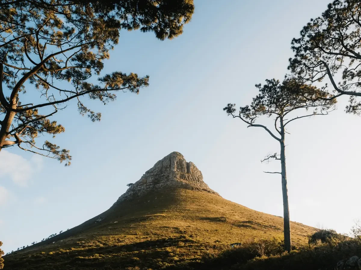
Lion’s Head
Key Stats:
- Distance (Lion’s Head summit loop): 3.1 mi / 5 km
- Elevation gain: ≈ 1,400 ft / 430 m
- Time: 1.5–2 hours round trip
- Difficulty: Easy to moderate; spiral track with occasional chains and rungs near the top
- Trailhead & parking: Nek parking on the Lion’s Head side of Tafelberg Road
- Contour Path distance: Variable 6–8 mi circuiting Table Mountain at ≈ 1,800 ft contour
While not a true Table-top ascent, Lion’s Head is stitched into the broader network of Table Mountain hiking trails and offers 360-degree breathtaking views over Cape Town and the Atlantic surf. A well-graded spiral leads walkers to chain-protected rock steps near the highest point; less confident hikers can take an easier ladder bypass. Just below, the contour path circumnavigates the mountain, connecting boulder parking, Pipe Track, Skeleton Gorge, and Platteklip Gorge trailheads, perfect for those who want an easy walk with constant great views without committing to a full summit ascent.
Nursery Ravine
Key Stats:
- Distance: 0.9 mi / 1.4 km from Kirstenbosch to Skeleton-Nursery junction; 2.7 mi / 4.4 km total if you summit
- Elevation gain: ≈ 2,050 ft / 625 m
- Time: 2–2.5 hours to reach the tabletop; add 45 minutes to the upper cable car station
- Difficulty: Moderate; steep stone staircases through a shaded ravine
- Trailhead & parking: Same as Skeleton Gorge at Kirstenbosch Gardens
- Navigation clue: Well-built steps merge with the Skeleton Gorge trail above fern forests
Less crowded than its neighbour, Nursery Ravine hiking trail offers a lung-busting stair master beneath a canopy of tree ferns and yellowwoods before bursting onto open heath. At the summit, Nursery Ravine merges with the Skeleton Gorge trail (this junction marks the official Skeleton Gorge distance), giving hikers two choices: continue east to Maclear’s Beacon, the mountain’s highest point, or head west across the tabletop to the upper cable car station for an effortless ride down to the lower cable car station. The ravine is prized for spring orchids, cool shade, and a tranquillity seldom found on more popular routes.
CURATED TRAVEL
Need help booking a seamless journey to your destination?
Let us plan your itinerary from start to finish, with carefully selected stays, seamless routing, and considered recommendations throughout. As a Fora Travel advisor, we’re able to secure upgrades, added amenities, and preferred access — at no extra cost to you.
Planning Your Ascent
Weather, Early Starts and Safety
Start your hike early in Cape Town, when the wind is typically lower, temperatures are moderate, and trailhead parking is more accessible. As the day progresses, conditions tend to change quickly. By midday, the south-easterly wind often strengthens, and the well-known “tablecloth” cloud can form over the summit, reducing visibility within minutes. According to the South African Weather Service, it is advisable to postpone your hike if the summit winds exceed 40 km/h or if thunderstorms are forecast.
Preparation should be practical and consistent. Carry a fully charged phone and save key emergency contacts before setting out. The primary numbers are Table Mountain National Park emergency services (+27 (086) 110 6417) and the Mountain Rescue ( +27 (021) 937 0300). Inform someone of your planned route and expected return time, particularly if you are hiking without a guide, which we highly recommend against.
Pack for variable conditions. Even on clear days, the summit can be significantly colder than the base, so a windbreaker or insulating layer is essential. Carry sufficient water in your backpack, and allow time for regular breaks, especially on steeper sections where sustained effort is required.
Plan your timing carefully. Begin your ascent early enough to complete your hike well before sunset, allowing a buffer for slower progress or changing conditions. Avoid descending during peak heat where possible, and remain on marked trails throughout to reduce the risk of disorientation or injury.
Elevation Gain, Steep Ascents and Fitness
Elevation gain on Table Mountain is concentrated over short distances, which makes even shorter routes physically demanding. Most ascents begin close to sea level and climb rapidly, often on uneven and steep stone steps or compacted rock. Routes such as Platteklip Gorge gain more than 2,000 feet in under 2 miles, and similar gradients are found across several of the mountain’s main hiking trails. This sustained incline places a consistent load on the legs and requires steady pacing rather than short bursts of effort.
Preparation should focus on endurance rather than speed. Stair climbing, incline walking, and weighted hill repeats are effective ways to build strength in the weeks leading up to your hike. A consistent, controlled pace is more sustainable than pushing too quickly early on. For most recreational hikers, an ascent rate of approximately 1,000 feet per hour allows for steady progress without excessive fatigue. Footing also plays a role in overall effort. Many sections of the trail are uneven, requiring balance and stability as well as strength. Taking shorter steps and maintaining a regular rhythm helps reduce strain, particularly on steeper sections where footing can vary.
The descent is often more demanding than expected. Continuous downward movement places significant pressure on the knees and quadriceps, especially on hard, stepped surfaces. Where possible, the cable car provides a practical option to avoid unnecessary strain. If descending on foot, reducing stride length and maintaining control on each step helps limit joint impact and fatigue.
Understanding how elevation gain translates into physical effort is key to planning your route and managing energy effectively throughout the hike.
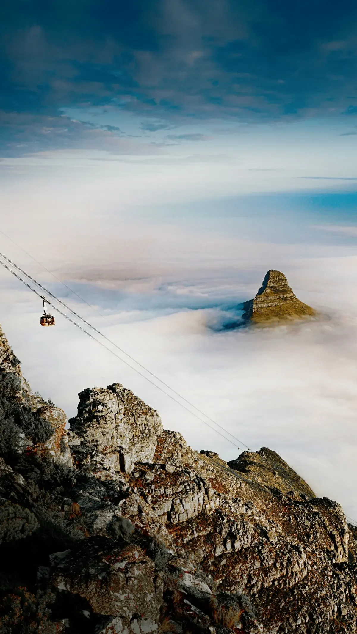
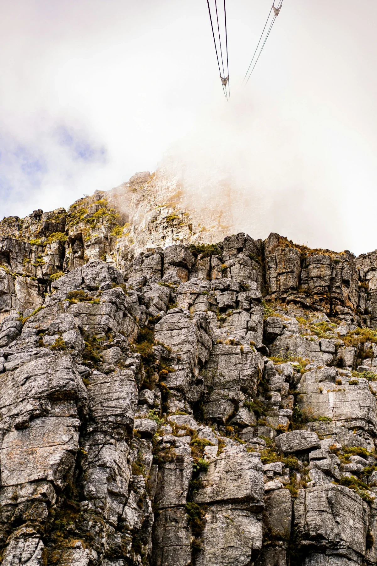
Using the Cable Car

The easiest way to reach the top of the mountain, especially for those who prefer not to hike, is the Table Mountain Aerial Cableway. The cable car offers a 7-minute ride to the top, accommodates 60 people per car, providing 360° panoramic views of Cape Town as the floor rotates clockwise. The cost for a round trip is R210, and tickets can be purchased online in advance. The cable car operates daily with varying hours depending on the month, but may close in bad weather conditions such as winds over 100 kph, lightning, or power outages. Hiking Table Mountain is free, but using the aerial cable car requires a ticket and is a fun and often preferred mode of reaching the top of the mountain by most people. If stranded, the quickest foot descent from the top station is Platteklip Gorge.
Navigation: Reading the Map
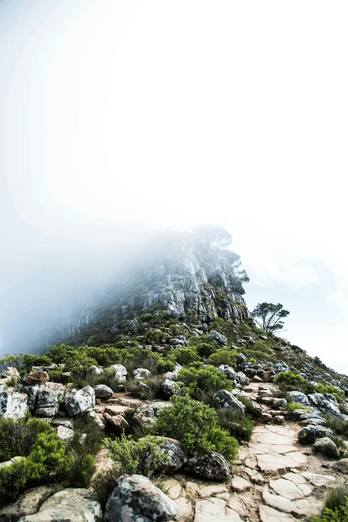
Navigation on Table Mountain requires attention, particularly in areas where terrain and visibility can change quickly. Mobile reception is not consistent across the mountain, especially in ravines and along steeper sections, so it is advisable to download offline maps or carry a printed Table Mountain hiking map, such as the Slingsby edition. Wayfinding markers vary by route. On India Venster, painted yellow footprints indicate the correct line of ascent, while red markers are used to identify emergency escape routes, including Porcupine Ravine. These markers are reliable but require active awareness, particularly where the trail crosses exposed rock or splits across multiple directions.
The summit plateau presents a different challenge. Although it appears open and flat, visibility can drop quickly when the cloud moves in, making it difficult to distinguish between paths. Cairns are used to guide your course, but several routes converge across the plateau, which can create confusion if you are not tracking your position carefully. If visibility changes or you lose the line of the trail, the safest approach is to return to the last confirmed marker rather than continuing forward. Clear navigation, combined with being prepared and constant awareness, is essential for moving confidently and safely across the mountain.
Flora, Fauna, and Conservation Ethics
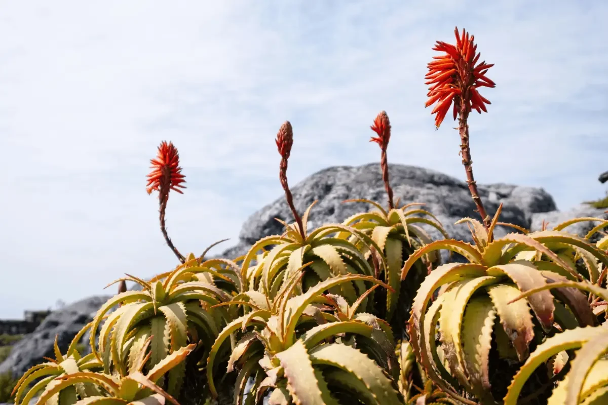
Table Mountain forms part of the Cape Floristic Region, one of the most biologically diverse areas on earth, with an exceptionally high concentration of plant species in a relatively small area. The dominant vegetation is fynbos, a shrubland ecosystem adapted to nutrient-poor soils, seasonal rainfall, and periodic fire. Species such as the king protea and silver tree depend on natural fire cycles to regenerate, with seeds often released or activated only after exposure to heat. This makes the landscape highly sensitive to disturbance, and even minor disruption can affect long-term regeneration.
Wildlife is present but not always immediately visible. Smaller species, including rock hyrax, porcupines, and endemic reptiles such as girdled lizards, are commonly found across the mountain, while larger animals like caracals are more elusive. These animals move through the same spaces as hikers, and interaction should be limited. Feeding, approaching, or attempting to handle wildlife is not permitted and can alter natural behaviour patterns.
Conservation on Table Mountain relies heavily on responsible visitor behavior. When you visit the mountain, staying on designated trails helps prevent erosion and protects fragile plant systems that do not recover easily once damaged. Shortcuts, off-trail movement, and trampling vegetation can disrupt seed cycles and degrade soil structure. All waste should be carried out, including food and biodegradable items, as the ecosystem does not process foreign materials efficiently. Collecting plant material is prohibited. Many species are protected, and removing even a single flower or cutting can have broader ecological consequences. Photography provides a non-invasive way to engage with the landscape while preserving its integrity.
Understanding these principles is part of moving responsibly through Table Mountain National Park. The environment is resilient within its natural cycles but remains vulnerable to human impact, making awareness and restraint essential components of the hiking experience.
Final Thoughts: Awaken Your Spirit on Table Mountain
Choosing a route up Table Mountain is not only about reaching the summit, but about understanding how the landscape unfolds as you move through it. Conditions, terrain, and perspective shift steadily, and planning your route with care allows you to experience the mountain in a way that feels measured and considered. Start early, providing sufficient time, monitor the weather, and prepare for changing conditions so that your time on the mountain remains controlled and enjoyable.
For many visitors, the hike forms part of a broader exploration of the region. After time on the mountain, you can continue not far inland to one of the Western Cape’s finest game reserves, where the landscape opens into a very different environment shaped by wildlife and open terrain. Alternatively, the nearby winefarms offer a slower pace, with vineyard landscapes and small towns that contrast with the vertical terrain of the mountain.
Approached in this way, hiking Table Mountain becomes part of a wider experience of the Western Cape, connecting the mountain to the surrounding regions in a way that is both practical and cohesive.
Pin This for Later